Odori大通
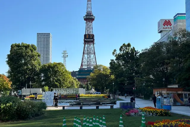
A long park running east–west through the city center, and the site of the winter Snow Festival. The TV Tower at its east end looks over it.
- Nature
- Views
- about 60 min
- Partly paid
- Wheelchair & stroller friendly
Walk · About 12 min from Sapporo
Events held here
- Feb 4 – Feb 11Sapporo Snow Festival 2027Japan's biggest snow festival, with giant snow sculptures in Odori Park and ice sculptures in Susukino.
- Nov 20 – Dec 2546th Sapporo White Illumination (Odori site)One of Japan's earliest illumination events, started in 1981, centered on Odori Park.
- Nov 20 – Dec 2525th Munich Christmas Market in SapporoA Christmas market honoring sister city Munich, with crafts, mulled wine and hot food in Odori Park.
Dates, times and details can change, for example because of the weather. Please check the official information before you go.
Sapporo guide
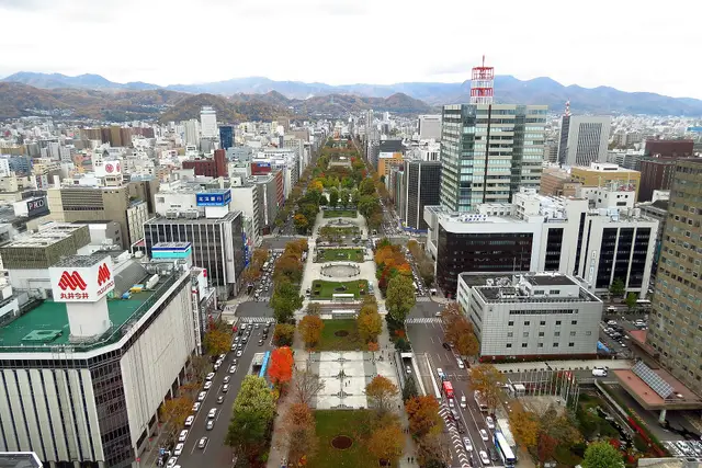
Odori Park, the Clock Tower and the red-brick former government office are all within walking distance on a grid of streets. Hokkaido's main city, also known for ramen, beer and the night view from Mt. Moiwa.
Things to see 10 classics
"Classics" and "Hidden gems" are this site's editorial picks, not a measured popularity ranking.
By interest
By how you get there
By distance
- 1
Odori Park and Sapporo TV Tower
A long park running east–west through the city center, and the site of the winter Snow Festival. The TV Tower at its east end looks over it.
- Nature
- Views
about 60 minPartly paidWheelchair & stroller friendly
Walk · About 12 min from Sapporo ・ 100m from here
- 2
Sapporo Clock Tower
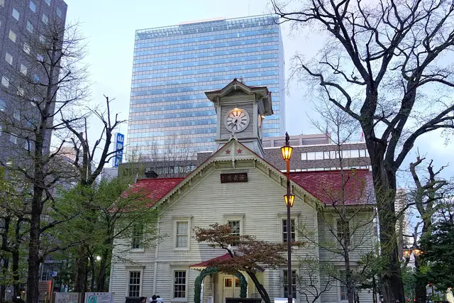
A wooden hall built in 1878 as the drill hall of Sapporo Agricultural College. The clock still chimes, and there is a small museum inside.
- History & buildings
about 30 minPaid entryFine on a rainy dayWheelchair & stroller friendly
Walk · About 10 min from Sapporo ・ 200m from here
- 3
Former Hokkaido Government Office (Red Brick Office)
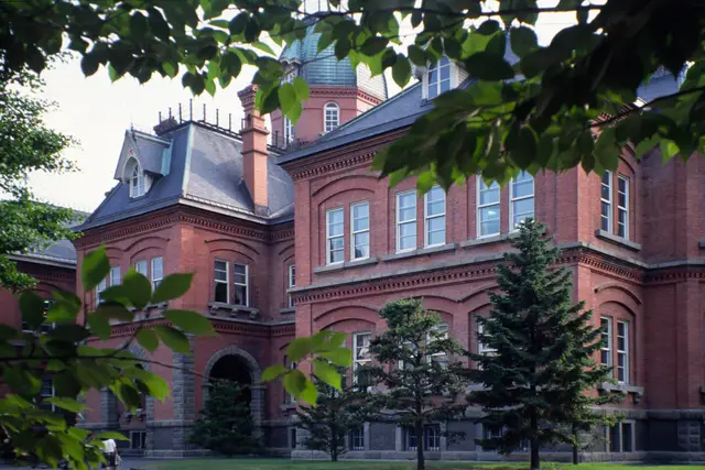
A red-brick government building from 1888. The front garden with its ponds and trees is a short, pleasant walk from the station.
- History & buildings
- Museums
about 45 minPaid entryFine on a rainy dayWheelchair & stroller friendly
Walk · About 8 min from Sapporo ・ 700m from here
- 4
Mt. Moiwa
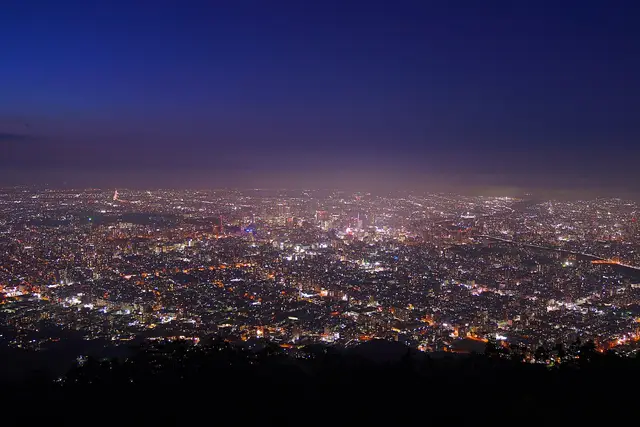
The hill for Sapporo's night view, looking down on the city lights. A ropeway and a mini cable car take you to the top.
- Views
- Night views
about 60 minFreeWheelchair & stroller friendly
Ropeway · About 60 min from Sapporo ・ Subway to Susukino, streetcar to Ropeway Iriguchi, then the shuttle bus and ropeway ・ 5.0km from here
- 6
Sapporo Beer Museum
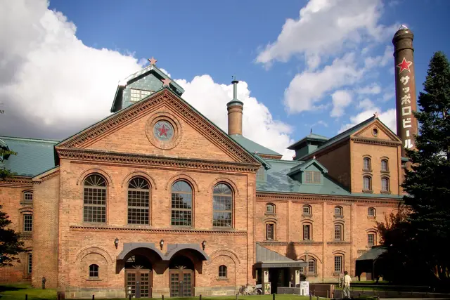
A beer museum in a red-brick Meiji-era building. The beer hall next door serves jingisukan, grilled lamb.
- History & buildings
- Food & markets
about 60 minFreeFine on a rainy dayPartly step-free
Bus · About 25 min from Sapporo ・ Bus from the north exit of Sapporo Station to Sapporo Beer Garden ・ 1.7km from here
Connections from here
Everything you can branch out to from here, on one map. Tap any item to open it.
Odori
Area guide
Upcoming events
Within walking distance
Facilities & features
- Coin lockers and baggage storage
- Easy step-free access
- Transfers take a little longer
- Typical transfer time: about 5 min
Lines from here
Within walking distance of this station
See nearby on a mapPlaces you can drop by on foot after leaving the station. Times are estimates.
- Go hereSapporo Clock TowerAbout 4 min on foot
A wooden hall built in 1878 as the drill hall of Sapporo Agricultural College. The clock still chimes, and there is a small museum inside.
- Go hereSusukinoAbout 10 min on foot
A nightlife district known for its neon-lit crossing and packed with restaurants and bars. The alley of ramen shops is here too.
- Go hereTanukikoji Shopping StreetAbout 6 min on foot
A covered shopping street running seven blocks between South 2 and South 3. Handy for souvenirs and snacks.
- Go hereSosei River ParkAbout 6 min on foot
A long, narrow park along the Sosei River, which splits the city east and west. Brick artworks dot the riverside path.
Tips for this place
Write a tipNo tips match these filters yet.
Questions about this place
Ask a questionNo questions yet. Ask about getting here, tickets or luggage.