南富山駅前
Toyama, Tateyama and Takaoka guide
A bayside capital with the Tateyama peaks rising behind. A canal park and art museums lie north of the station, the castle and trams to the south; trains run on to the Alps, Kurobe Gorge and Takaoka.
Things to see 12 classics
"Classics", "For visitors" and "Local picks" are this site's editorial picks, not a measured popularity ranking.
By interest
By how you get there
By distance
- 1
Fugan Canal Kansui Park
A park on the old canal basin. On clear days the towers of Tenmon Bridge look out to the Tateyama range. Home to a famous Starbucks.
- Nature
- Views
FreeWheelchair & stroller friendly
Walk · About 10 min from Toyama ・ About 9 minutes on foot from the north exit of Toyama Station ・ 4.4km from here
- 2
Toyama Prefectural Museum of Art and Design
A museum of art and design. Entry to the building is free; the rooftop play garden, Onomatopoeia Rooftop, closes from December to mid-March.
- Museums
- Views
- With kids
Partly paidFine on a rainy dayWheelchair & stroller friendly
Walk · About 15 min from Toyama ・ About 15 minutes on foot from the north exit of Toyama Station; buses also run ・ 4.5km from here
- 3
Toyama Glass Art Museum
Inside TOYAMA Kirari, a building designed by Kengo Kuma. The 6th floor shows glass installations by Dale Chihuly.
- Museums
Paid entryFine on a rainy day
Tram · About 15 min from Toyama ・ City tram to Nishicho (about 12 minutes), then about 1 minute on foot ・ 2.1km from here
- 4
Toyama Castle Park and the Matsukawa River
A park on the castle site. The keep, rebuilt in 1954, holds a local history museum. The Matsukawa River alongside is a cherry blossom spot.
- History & buildings
- Nature
Partly paid
Walk · About 10 min from Toyama ・ About 10 minutes on foot from Toyama Station ・ 2.7km from here
- 5
Iwase old port town
A port town of the Kitamaebune trade. Old merchant houses and storehouses hold sake shops and eateries. Mori House is closed for repairs.
- History & buildings
- Food & markets
- Shopping & strolling
Tram · About 35 min from Toyama ・ Toyamako Line tram from Toyama Station to Higashi-Iwase (about 25 minutes), then about 10 minutes on foot ・ 9.4km from here
- 6
Murodo on the Tateyama Kurobe Alpine Route
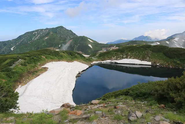
A high plateau ringed by 3,000 m peaks, with the Yuki-no-Otani snow walls in spring. Open from mid-April to the end of November only.
- Nature
- Views
- Activities
Paid entry
Bus · About 150 min from Toyama ・ Dentetsu-Toyama to Tateyama (about 1 hour), then the Tateyama Cable Car (about 7 minutes) and the highland bus (about 50 minutes) ・ 35km from here
“Classics”, “For visitors” and “Local picks” are our editors' picks, not a measured popularity ranking. Travel times are estimates. Please check prices, opening hours and operating days with the official sources before you go.
Photo and data credits
Mikurigaike Pond with lingering snow at Murodo, Tateyama Alpsdake (CC BY-SA 4.0). Cropped and resized.
Facilities & features
- Elevators available (the route may be longer)
Lines from here
Tips for this place
Write a tipNo tips match these filters yet.
Questions about this place
Ask a questionNo questions yet. Ask about getting here, tickets or luggage.
Nearby places
Practical booking & planning links (Ad)
We list only well-established booking services. This site may receive a commission if you book through these links (each opens in a new tab).