A mountain on Tokyo's western edge, about an hour by train from Shinjuku. Ride the cable car halfway, walk past Yakuo-in Temple to the summit, then soak in the hot spring by the station afterward.
"Classics", "For visitors" and "Local picks" are this site's editorial picks, not a measured popularity ranking.
The 599-meter summit. On clear days you can see Mt. Fuji to the west and central Tokyo and the bay to the east.
about 45 minFree
Ropeway · About 60 min from Takaosanguchi ・ Cable car to Takaosan Station, then about 40 minutes on foot along Trail 1 ・ 5.4km from here
“Classics”, “For visitors” and “Local picks” are our editors' picks, not a measured popularity ranking. Travel times are estimates. Please check prices, opening hours and operating days with the official sources before you go.
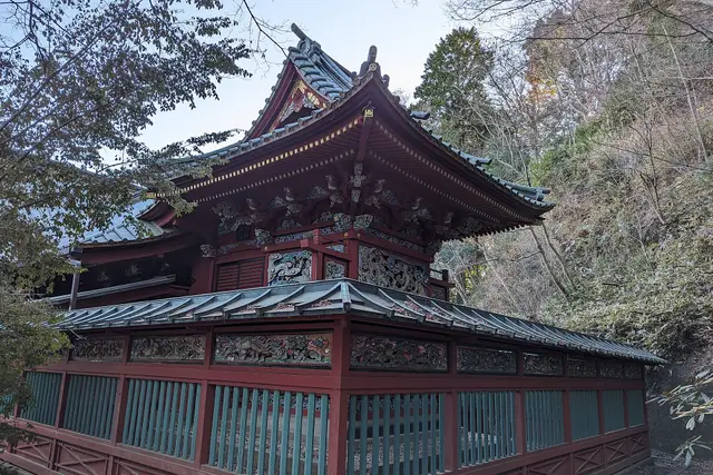
A red-lacquered shrine hall on Mount Takao Syced (CC0). Cropped and resized.
No tips match these filters yet.
No questions yet. Ask about getting here, tickets or luggage.
We list only well-established booking services. This site may receive a commission if you book through these links (each opens in a new tab).
ClassicsFor visitorsLocal picks
Times assume a 9:00 start. Travel times are estimated from distance and vary with waiting and crowds.
Leave 9:00 → until about 17:30 (about 8.5 hr)
about 5 min on foot
about 18 min on foot
about 12 min on foot
about 10 min on foot
about 15 min by transport
A common plan is the cable car up and Trail 6 along the stream or Trail 1 down. Wear good walking shoes.
Plan this routeLeave 9:00 → until about 14:59 (about 6 hr)
about 4 min on foot
about 16 min on foot
about 26 min on foot
about 15 min by transport
March–May and October–November are best for walking. July–August is hot and humid (26–27°C on average); September–October is the wettest. Winter is dry and sunny.
Point at a month to see its temperature and precipitation.
Temperature (line: average; band: low to high)
Precipitation (mm)
Typical seasons
Cherry blossoms (Ueno, Chidorigafuchi)
Sanja Festival (Asakusa)
Sumida River Fireworks
Autumn leaves (ginkgo avenues)
| Jan | Feb | Mar | Apr | May | Jun | Jul | Aug | Sep | Oct | Nov | Dec | |
|---|---|---|---|---|---|---|---|---|---|---|---|---|
| High (℃) | 9.8 | 10.9 | 14.2 | 19.4 | 23.6 | 26.1 | 29.9 | 31.3 | 27.5 | 22 | 16.7 | 12 |
| Avg (℃) | 5.4 | 6.1 | 9.4 | 14.3 | 18.8 | 21.9 | 25.7 | 26.9 | 23.3 | 18 | 12.5 | 7.7 |
| Low (℃) | 1.2 | 2.1 | 5 | 9.8 | 14.6 | 18.5 | 22.4 | 23.5 | 20.3 | 14.8 | 8.8 | 3.8 |
| Rain (mm) | 59.7 | 56.5 | 116 | 133.7 | 139.7 | 167.8 | 156.2 | 154.7 | 224.9 | 234.8 | 96.3 | 57.9 |
Temperature and precipitation are Japan Meteorological Agency normals (1991–2020, Tokyo). Seasons are typical timings and can shift by a week or two each year. JMA data
Keio Line (Shinjuku – Takaosanguchi)
About 50 minutes from Shinjuku to Takaosanguchi by the Keio limited express, no change needed. Cheaper than JR; crowded with hikers on weekend mornings.
JR Chuo Line (Takao, Hachioji)
From Tokyo or Shinjuku to Takao, then one stop on the Keio Line to Takaosanguchi. Buses for Mt. Jimba also leave from Takao Station.
Mt. Takao cable car and chairlift
About 6 minutes from Kiyotaki Station to the mid-slope by cable car or chairlift. The open chairlift can stop in bad weather.
about 13 min on foot
Trail 6 crosses the stream in places and gets slippery after rain. It takes about 90 minutes to the summit.