Tokyo Idai-Byōin (Tokyo Medical Univ. Hp. )東京医大病院前
Shinjuku guide
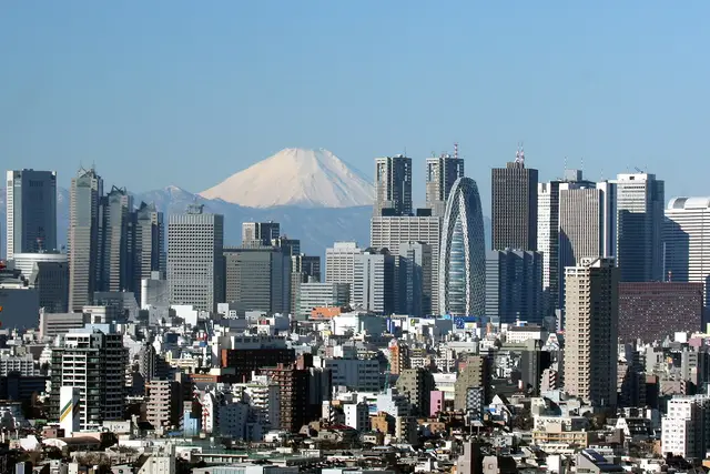
Skyscrapers on the west side, department stores and the neon of Kabukicho on the east. Shinjuku Gyoen lies to the south and multicultural Okubo to the north. At night, try the tiny bars of the alleys.
Things to see 5 classics
"Classics", "For visitors" and "Local picks" are this site's editorial picks, not a measured popularity ranking.
By interest
By how you get there
By distance
- 1
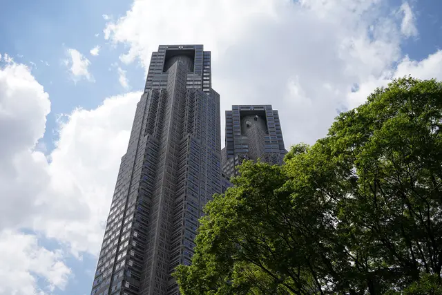
Shinjuku (Tokyo Metropolitan Government observatories)
The city hall's observatories, about 200 meters up among the skyscrapers, look out over Tokyo. At night, head for the neon of the east side.
- Views
- Night views
about 60 minFreeFine on a rainy day
Train · About 30 min from Shinjuku ・ JR Chuo Line rapid to Shinjuku, then about 10 minutes on foot from the west exit ・ 600m from here
- 2
Shinjuku Gyoen National Garden
A large garden combining French, English and Japanese styles. Many cherry varieties bloom in turn, so the blossom season lasts a long time.
- Nature
- History & buildings
about 1.5 hrPaid entry
Train · About 30 min from Shinjuku ・ JR Chuo Line rapid to Shinjuku, then about 10 minutes on foot from the south exit ・ 1.9km from here
- 3
Kabukicho (Godzilla Road)
A nightlife district where a giant Godzilla head peers over a cinema and hotel building. Never follow street touts into bars.
- Night views
- Views
about 45 minFree
Walk · About 7 min from Shinjuku ・ About 7 minutes on foot from the East Exit ・ 900m from here
- 4
Isetan Shinjuku
A department store in an early-Showa building. The basement food hall is packed with Japanese sweets, bento and deli dishes.
- Shopping & strolling
- Food & markets
about 60 minFreeFine on a rainy day
Walk · About 8 min from Shinjuku ・ About 8 minutes on foot from the East Exit (also via the underground passage) ・ 1.2km from here
- 5
Sompo Museum of Art
An art museum where Van Gogh's Sunflowers is always on view, at the foot of a west-side skyscraper.
- Museums
about 60 minPaid entryFine on a rainy day
Walk · About 7 min from Shinjuku ・ About 7 minutes on foot from the West Exit ・ 400m from here
“Classics”, “For visitors” and “Local picks” are our editors' picks, not a measured popularity ranking. Travel times are estimates. Please check prices, opening hours and operating days with the official sources before you go.
Photo and data credits
The Shinjuku skyscraper cluster with Mount Fuji beyond Morio (CC BY-SA 3.0) / The twin towers of the Tokyo Metropolitan Government Building Eavesdropper6735 (CC BY 4.0). Cropped and resized.
Facilities & features
- Elevators available (the route may be longer)
- Typical transfer time: about 4 min
Lines from here
Within walking distance of here
See nearby on a mapWalking times are estimates from the straight-line distance.
- Go hereSompo Museum of ArtAbout 7 min on foot
An art museum where Van Gogh's Sunflowers is always on view, at the foot of a west-side skyscraper.
- Go hereShinjuku (Tokyo Metropolitan Government observatories)About 9 min on foot
The city hall's observatories, about 200 meters up among the skyscrapers, look out over Tokyo. At night, head for the neon of the east side.
- Go hereLOVE sculpture (Shinjuku i-Land)About 4 min on foot
Robert Indiana's LOVE sculpture at the foot of a skyscraper, a favorite photo stop on the west side.
- Go hereMemorial Museum for Soldiers, Detainees in Siberia, and Postwar RepatriatesAbout 6 min on foot
A national museum inside a skyscraper on life after World War II: Siberian detention and the return of Japanese from overseas.
Tips for this place
Write a tipNo tips match these filters yet.
Questions about this place
Ask a questionNo questions yet. Ask about getting here, tickets or luggage.
Nearby places
Practical booking & planning links (Ad)
We list only well-established booking services. This site may receive a commission if you book through these links (each opens in a new tab).