Hakodate函館
Hakodate guide
Hillside churches and Western-style houses, a star-shaped fort, a famous night view and a seafood market. A port city that is easy to get around by tram.
Things to see 10 classics
"Classics" and "Hidden gems" are this site's editorial picks, not a measured popularity ranking.
By interest
By how you get there
By distance
- 1
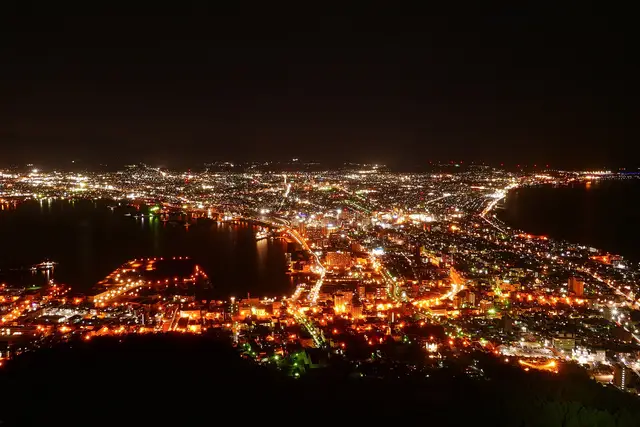
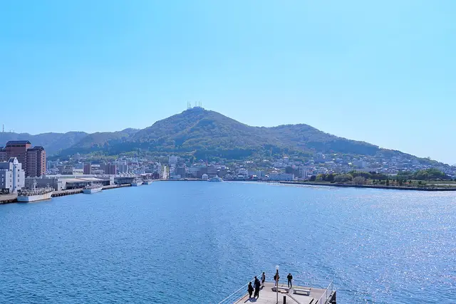
Mt. Hakodate
A night view of the city lights between two bays. Go up a little before sunset to watch the light change.
- Views
- Night views
about 60 minFreeWheelchair & stroller friendly
Ropeway · About 30 min from Hakodate ・ Tram to Jujigai, walk to the base station, then the ropeway ・ 2.5km
- 2
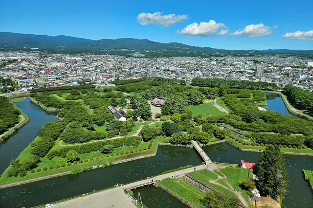
Goryokaku Park and Tower
A star-shaped fort from the 1860s. The tower shows the star from above. Famous for cherry blossoms in spring.
- History & buildings
- Views
- Nature
about 1.5 hrPartly paid
Tram · About 35 min from Hakodate ・ Tram to Goryokaku-Koen-Mae, then about 15 minutes on foot ・ 3.6km
- 3
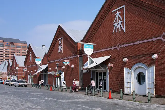
Kanemori Red Brick Warehouses
Shops and restaurants in Meiji-era warehouses along the harbor. Pretty when lit at night.
- Shopping & strolling
- History & buildings
- Night views
about 60 minFreeFine on a rainy day
Walk · About 15 min from Hakodate ・ 1.2km
- 4
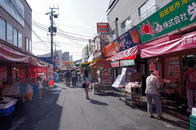
Hakodate Morning Market
Right next to the station. Seafood rice bowls and squid fishing. Busiest from early morning until around noon.
- Food & markets
- Shopping & strolling
about 60 minFreeFine on a rainy day
Walk · About 3 min from Hakodate ・ 100m
- 5
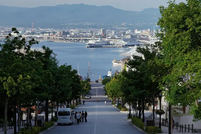
Motomachi and Hachiman-zaka Slope
The classic Hakodate view: a straight slope running down to the harbor, with churches and Western-style houses all around.
- History & buildings
- Views
- Anime & film
about 1.5 hrFree
Tram · About 15 min from Hakodate ・ Tram to Suehirocho, then about 5 minutes on foot ・ 1.7km
- 6
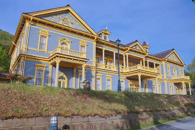
Old Public Hall of Hakodate Ward
A blue and yellow Western-style hall from 1910. The balcony looks out over the harbor.
- History & buildings
- Museums
about 45 minPaid entryFine on a rainy dayPartly step-free
Tram · About 20 min from Hakodate ・ Tram to Suehirocho, then about 7 minutes on foot ・ 1.8km
“Classics” and “Hidden gems” are our editors' picks, not a measured popularity ranking. Travel times are estimates. Please check prices, opening hours and operating days with the official sources before you go.
Photo and data credits
Night view of Hakodate between two bays, seen from Mt. Hakodate MaedaAkihiko (CC BY-SA 4.0) / Mt. Hakodate rising beyond Hakodate Harbor under a blue sky 掬茶 (CC BY-SA 4.0) / The star-shaped Goryokaku fort seen from Goryokaku Tower 姒姓賢寧 (CC BY-SA 4.0) / The Kanemori Red Brick Warehouses under a blue sky 663highland (CC BY 2.5) / A street of seafood stalls at the Hakodate Morning Market 663highland (CC BY 2.5) / Tree-lined Hachiman-zaka Slope running straight down to the harbor 663highland (CC BY-SA 4.0) / The blue-and-yellow Old Public Hall of Hakodate Ward 掬茶 (CC BY-SA 4.0). Cropped and resized.
Connections from here
Everything you can branch out to from here, on one map. Tap any item to open it.
Hakodate
Area guide
Themes
Nearby places in the same theme
Facilities & features
- Coin lockers and baggage storage
- Easy step-free access
- Typical transfer time: about 5 min
Lines from here
Within walking distance of this station
See nearby on a mapPlaces you can drop by on foot after leaving the station. Times are estimates.
- Go hereHakodate Morning MarketAbout 2 min on foot
Right next to the station. Seafood rice bowls and squid fishing. Busiest from early morning until around noon.
Sights are this site's picks, not a popularity ranking.
Tips for this place
Write a tipNo tips match these filters yet.
Questions about this place
Ask a questionNo questions yet. Ask about getting here, tickets or luggage.