Hakodate guide
Hillside churches and Western-style houses, a star-shaped fort, a famous night view and a seafood market. A port city that is easy to get around by tram.
Things to see 10 classics
"Classics" and "Hidden gems" are this site's editorial picks, not a measured popularity ranking.
- 1
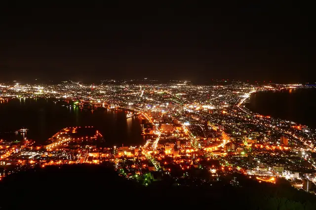
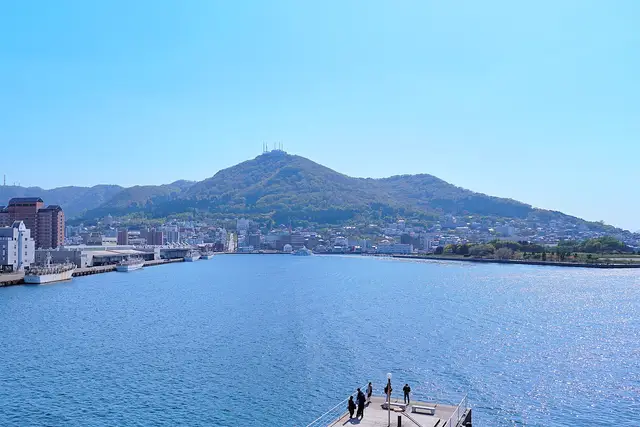
Mt. Hakodate
A night view of the city lights between two bays. Go up a little before sunset to watch the light change.
- Views
- Night views
about 60 minFreeWheelchair & stroller friendly
Ropeway · About 30 min from Hakodate ・ Tram to Jujigai, walk to the base station, then the ropeway ・ 2.5km
- 2
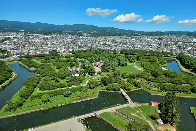
Goryokaku Park and Tower
A star-shaped fort from the 1860s. The tower shows the star from above. Famous for cherry blossoms in spring.
- History & buildings
- Views
- Nature
about 1.5 hrPartly paid
Tram · About 35 min from Hakodate ・ Tram to Goryokaku-Koen-Mae, then about 15 minutes on foot ・ 3.6km
- 3
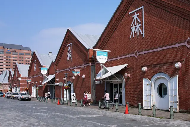
Kanemori Red Brick Warehouses
Shops and restaurants in Meiji-era warehouses along the harbor. Pretty when lit at night.
- Shopping & strolling
- History & buildings
- Night views
about 60 minFreeFine on a rainy day
Walk · About 15 min from Hakodate ・ 1.2km
- 4
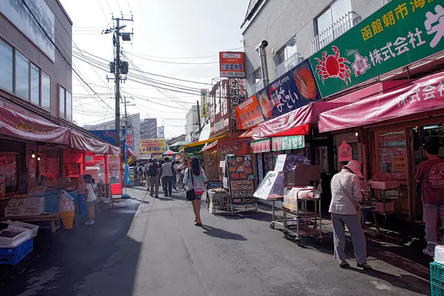
Hakodate Morning Market
Right next to the station. Seafood rice bowls and squid fishing. Busiest from early morning until around noon.
- Food & markets
- Shopping & strolling
about 60 minFreeFine on a rainy day
Walk · About 3 min from Hakodate ・ 100m
- 5
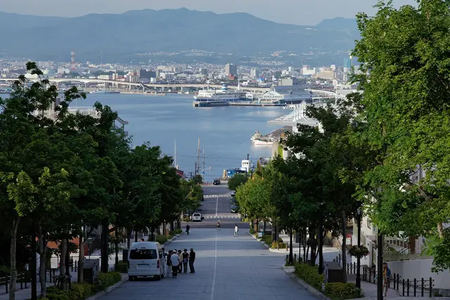
Motomachi and Hachiman-zaka Slope
The classic Hakodate view: a straight slope running down to the harbor, with churches and Western-style houses all around.
- History & buildings
- Views
- Anime & film
about 1.5 hrFree
Tram · About 15 min from Hakodate ・ Tram to Suehirocho, then about 5 minutes on foot ・ 1.7km
- 6
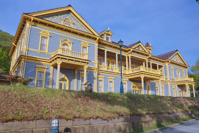
Old Public Hall of Hakodate Ward
A blue and yellow Western-style hall from 1910. The balcony looks out over the harbor.
- History & buildings
- Museums
about 45 minPaid entryFine on a rainy dayPartly step-free
Tram · About 20 min from Hakodate ・ Tram to Suehirocho, then about 7 minutes on foot ・ 1.8km
Show on map
ClassicsHidden gems
Suggested routes
Times assume a 9:00 start. Travel times are estimated from distance and vary with waiting and crowds.
Morning market, Motomachi, then Mt. Hakodate at dusk
Leave 9:00 → until about 15:03 (about 6 hr)
- 9:00Hakodate
about 3 min on foot
9:03Hakodate Morning Marketstay about 60 minabout 18 min on foot
10:21Kanemori Red Brick Warehousesstay about 60 minabout 10 min on foot
11:31Motomachi and Hachiman-zaka Slopestay about 1.5 hrabout 4 min on foot
13:05Old Public Hall of Hakodate Wardstay about 45 minabout 13 min on foot
14:03Mt. Hakodatestay about 60 min
Almost all on foot. There are many slopes, so wear comfortable shoes.
Plan this routeGoryokaku and Yunokawa Onsen
Leave 9:00 → until about 14:52 (about 6 hr)
- 9:00Hakodate
about 35 min by transport
9:35Goryokaku Park and Towerstay about 1.5 hrabout 20 min by transport
11:25Kosetsuen Garden (Miharashi Park)stay about 45 minabout 15 min by transport
12:25Hakodate Tropical Botanical Garden (bathing monkeys)stay about 45 minabout 12 min on foot
13:22Yunokawa Onsenstay about 1.5 hr
A one-day tram pass is handy for this route.
Plan this route
When to go
Early May (cherry blossoms) and July–August (about 20°C on average) are the easiest for walking. Winter averages around −2°C but the snowy night views are beautiful.
Point at a month to see its temperature and precipitation.
Temperature (line: average; band: low to high)
Precipitation (mm)
Typical seasons
Cherry blossoms (Goryokaku)
Hakodate Port Festival
Autumn leaves (Kosetsuen)
Snowy scenes
Show as a table
| Jan | Feb | Mar | Apr | May | Jun | Jul | Aug | Sep | Oct | Nov | Dec | |
|---|---|---|---|---|---|---|---|---|---|---|---|---|
| High (℃) | 0.9 | 1.8 | 5.8 | 12 | 17 | 20.4 | 24.1 | 25.9 | 23.2 | 17.1 | 10 | 3.2 |
| Avg (℃) | -2.4 | -1.8 | 1.9 | 7.3 | 12.3 | 16.2 | 20.3 | 22.1 | 18.8 | 12.5 | 6 | -0.1 |
| Low (℃) | -6 | -5.7 | -2.2 | 2.8 | 8 | 12.6 | 17.3 | 18.9 | 14.6 | 7.8 | 1.8 | -3.6 |
| Rain (mm) | 77.4 | 64.5 | 64.1 | 71.9 | 88.9 | 79.8 | 123.6 | 156.5 | 150.5 | 105.6 | 110.8 | 94.6 |
Temperature and precipitation are Japan Meteorological Agency normals (1991–2020, Hakodate). Seasons are typical timings and can shift by a week or two each year. JMA data
Main ways to get around
Hakodate City Tram
From Hakodate Station to Motomachi and the bay area (Jujigai, Suehirocho), Goryokaku-Koen-Mae and Yunokawa. Most sights are on the tram. A one-day pass is sold.
Mt. Hakodate Ropeway
About 10 minutes on foot from the Jujigai tram stop to the base station. Very crowded around sunset. It can stop for strong wind or maintenance.
Hakodate Bus
For places off the tram lines, such as the Trappistine Convent. The bus to the top of Mt. Hakodate does not run in winter.
Hakodate Liner (Shin-Hakodate-Hokuto – Hakodate)
About 15–20 minutes from Shin-Hakodate-Hokuto on the Hokkaido Shinkansen to Hakodate Station, timed to meet the bullet trains.
Airport shuttle bus
About 20 minutes from Hakodate Airport to Hakodate Station. Yunokawa Onsen is very close to the airport.
Getting to Hakodate
“Classics” and “Hidden gems” are our editors' picks, not a measured popularity ranking. Travel times are estimates. Please check prices, opening hours and operating days with the official sources before you go.
Photo and data credits
Night view of Hakodate between two bays, seen from Mt. Hakodate MaedaAkihiko (CC BY-SA 4.0) / Mt. Hakodate rising beyond Hakodate Harbor under a blue sky 掬茶 (CC BY-SA 4.0) / The star-shaped Goryokaku fort seen from Goryokaku Tower 姒姓賢寧 (CC BY-SA 4.0) / The Kanemori Red Brick Warehouses under a blue sky 663highland (CC BY 2.5) / A street of seafood stalls at the Hakodate Morning Market 663highland (CC BY 2.5) / Tree-lined Hachiman-zaka Slope running straight down to the harbor 663highland (CC BY-SA 4.0) / The blue-and-yellow Old Public Hall of Hakodate Ward 掬茶 (CC BY-SA 4.0). Cropped and resized.
Local food
Regional dishes handed down in Hokkaido. Many are home and community cooking, so not every dish is served at restaurants.
Matsumae-zuke
松前漬
"Matsumae-zuke" is a local Hokkaido delicacy made by shredding dried Squid, and Kelp, and marinating them with Soy sauce, Sake, Mirin, and Sugar.
- Where it is made
- Southern Hokkaido Area, Matsumae Town and Vicinity
Ruibe
ルイベ
"Ruibe" is local cuisine made by freezing fish like salmon or trout, then eating them as sashimi as it thaws out. It is characterized by its frozen texture and a taste that slowly melts in your mouth.
- Where it is made
- Ishikari City, Hakodate City, Kushiro City and many other coastal areas
Kujira-jiru
鯨汁
"Kujira-jiru" is an essential New Year's Dish in Southern Hokkaido.
- Where it is made
- Southern Hokkaido
Ikameshi
いかめし
Ikameshi is a famous local dish of the Hakodate and Oshima regions.
- Where it is made
- Southern Hokkaido area
Jingisukan (Lamb and Vegetable Hot Pot)
ジンギスカン/成吉思汗
During the Taisho era (1912-1926), as the outbreak of World War I made it difficult to import wool, there was a national policy to encourage sheep farming.
- Where it is made
- All of Hokkaido Prefecture
Sanpei-Jiru
三平汁
"Sanpei-jiru" is a local dish consisting of salted fish, such as salmon or herring, stewed together with vegetables, such as carrots, and daikon radishes.
- Where it is made
- All of Hokkaido Prefecture
“Find places serving it” opens a map app search for the dish name and the place name. The results are not chosen or recommended by this site. Please check with the shop whether it serves the dish.
Source: “Our Regional Cuisines” (Ministry of Agriculture, Forestry and Fisheries), edited by this site (imported 2026-11-15) https://www.maff.go.jp/e/policies/market/k_ryouri/index.html. Names, areas and ingredients are as written on the source pages; descriptions are excerpts of the original text. No photos are used. This page is not made or endorsed by the ministry.