Sign in to keep your visits and rank, and see them on your other devices.
Sign in
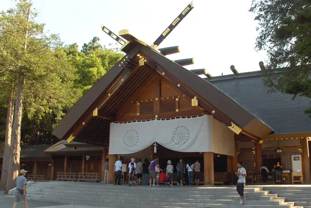
A shrine in the forest at the foot of Mt. Maruyama. Together with Maruyama Park next door, it is a cherry-blossom spot in spring.
Subway · About 30 min from Sapporo ・ Change at Odori to the Tozai Line for Maruyama-Koen, then about 15 minutes on foot
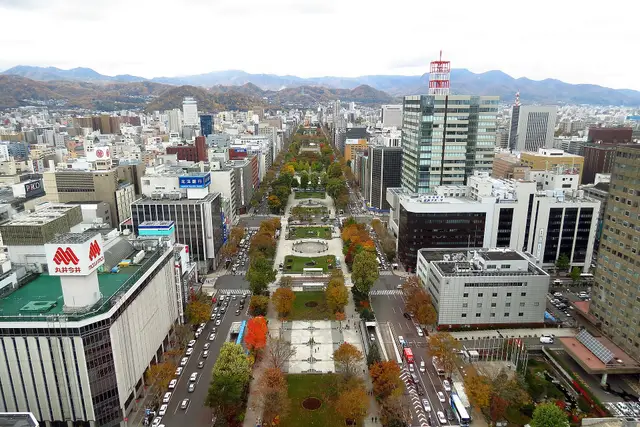
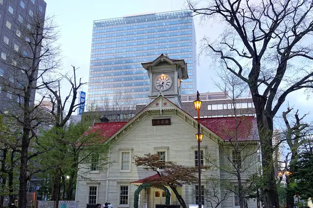
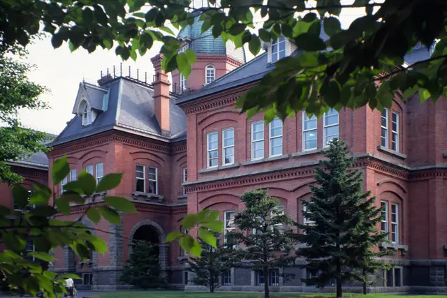
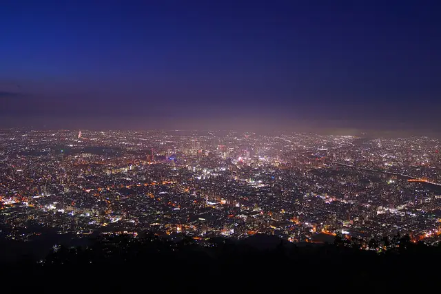
Odori Park, the Clock Tower and the red-brick former government office are all within walking distance on a grid of streets. Hokkaido's main city, also known for ramen, beer and the night view from Mt. Moiwa.
"Classics" and "Hidden gems" are this site's editorial picks, not a measured popularity ranking.
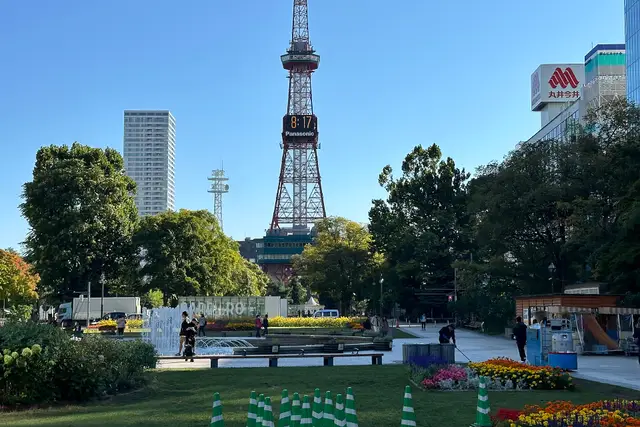
A long park running east–west through the city center, and the site of the winter Snow Festival. The TV Tower at its east end looks over it.
about 60 minPartly paidWheelchair & stroller friendly
Walk · About 12 min from Sapporo ・ 3.0km from here
A wooden hall built in 1878 as the drill hall of Sapporo Agricultural College. The clock still chimes, and there is a small museum inside.
about 30 minPaid entryFine on a rainy dayWheelchair & stroller friendly
Walk · About 10 min from Sapporo ・ 2.9km from here
A red-brick government building from 1888. The front garden with its ponds and trees is a short, pleasant walk from the station.
about 45 minPaid entryFine on a rainy dayWheelchair & stroller friendly
Walk · About 8 min from Sapporo ・ 2.5km from here
The hill for Sapporo's night view, looking down on the city lights. A ropeway and a mini cable car take you to the top.
about 60 minFreeWheelchair & stroller friendly
Ropeway · About 60 min from Sapporo ・ Subway to Susukino, streetcar to Ropeway Iriguchi, then the shuttle bus and ropeway ・ 3.7km from here
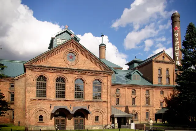
A beer museum in a red-brick Meiji-era building. The beer hall next door serves jingisukan, grilled lamb.
about 60 minFreeFine on a rainy dayPartly step-free
Bus · About 25 min from Sapporo ・ Bus from the north exit of Sapporo Station to Sapporo Beer Garden ・ 4.4km from here
No tips match these filters yet.
No questions yet. Ask about getting here, tickets or luggage.
ClassicsHidden gems
Times assume a 9:00 start. Travel times are estimated from distance and vary with waiting and crowds.
Leave 9:00 → until about 14:40 (about 5.5 hr)
about 8 min on foot
about 8 min on foot
about 4 min on foot
about 10 min on foot
about 25 min by transport
Everything as far as Susukino is walkable. For Mt. Moiwa, take the streetcar from Susukino.
Plan this routeLeave 9:00 → until about 13:27 (about 4.5 hr)
about 12 min on foot
about 20 min by transport
about 25 min by transport
Odori, Maruyama-Koen and Miyanosawa are all stations on the Tozai Line.
Plan this routeJune to September is mild (17–22°C on average), ideal for summer travel. February brings the Snow Festival but averages around −3°C, so dress for deep cold.
Point at a month to see its temperature and precipitation.
Temperature (line: average; band: low to high)
Precipitation (mm)
Typical seasons
Cherry blossoms (Maruyama Park)
Lilacs (Odori Park)
Sapporo Snow Festival
Autumn leaves (Nakajima Park, Jozankei)
Snowy city scenes
| Jan | Feb | Mar | Apr | May | Jun | Jul | Aug | Sep | Oct | Nov | Dec | |
|---|---|---|---|---|---|---|---|---|---|---|---|---|
| High (℃) | -0.4 | 0.4 | 4.5 | 11.7 | 17.9 | 21.8 | 25.4 | 26.4 | 22.8 | 16.4 | 8.7 | 2 |
| Avg (℃) | -3.2 | -2.7 | 1.1 | 7.3 | 13 | 17 | 21.1 | 22.3 | 18.6 | 12.1 | 5.2 | -0.9 |
| Low (℃) | -6.4 | -6.2 | -2.4 | 3.4 | 9 | 13.4 | 17.9 | 19.1 | 14.8 | 8 | 1.6 | -4 |
| Rain (mm) | 108.4 | 91.9 | 77.6 | 54.6 | 55.5 | 60.4 | 90.7 | 126.8 | 142.2 | 109.9 | 113.8 | 114.5 |
Temperature and precipitation are Japan Meteorological Agency normals (1991–2020, Sapporo). Seasons are typical timings and can shift by a week or two each year. JMA data
Sapporo Municipal Subway
Three lines: Namboku, Tozai and Toho. From Sapporo Station to Odori, Susukino and Makomanai; change at Odori for Maruyama-Koen and Miyanosawa.
Underground walkway (Chi-Ka-Ho)
About 10 minutes on foot underground from Sapporo Station to Odori. An underground mall continues on to Susukino, so walking is easy even on snowy days.
Sapporo Streetcar
A loop line running from Susukino and Nishi 4-chome around the southwest of the city. Get off at Ropeway Iriguchi for the Mt. Moiwa Ropeway.
Mt. Moiwa Ropeway
A shuttle bus runs from the Ropeway Iriguchi tram stop to the base station. Ride the ropeway, then a mini cable car to the top. It can stop for strong wind or maintenance.
Rapid Airport (New Chitose Airport – Sapporo)
About 40 minutes from New Chitose Airport to Sapporo Station. Some trains continue to Otaru. Delays are possible on snowy days.
“Classics” and “Hidden gems” are our editors' picks, not a measured popularity ranking. Travel times are estimates. Please check prices, opening hours and operating days with the official sources before you go.
Odori Park in autumn and central Sapporo, seen from the TV Tower redlegsfan21 (CC BY-SA 2.0) / Flower beds in Odori Park with the Sapporo TV Tower ノボホショコロトソ (CC BY 4.0) / The Sapporo Clock Tower among trees Bjørn Christian Tørrissen (CC BY-SA 4.0) / The red-brick Former Hokkaido Government Office surrounded by trees user:Fg2 (Public domain) / Night view of Sapporo from Mt. Moiwa 掬茶 (CC BY-SA 4.0) / The red-brick Sapporo Beer Museum under a blue sky MIKI Yoshihito derivative work: MrPanyGoff (CC BY 2.0) / The worship hall of Hokkaido Jingu Shrine among trees Daigaku2051 (CC BY-SA 3.0). Cropped and resized.
No transfers
Times and fares (one adult) are estimates for a 9:00 a.m. departure. Tap a card to compare options for your own date and needs.