삿포로 가이드
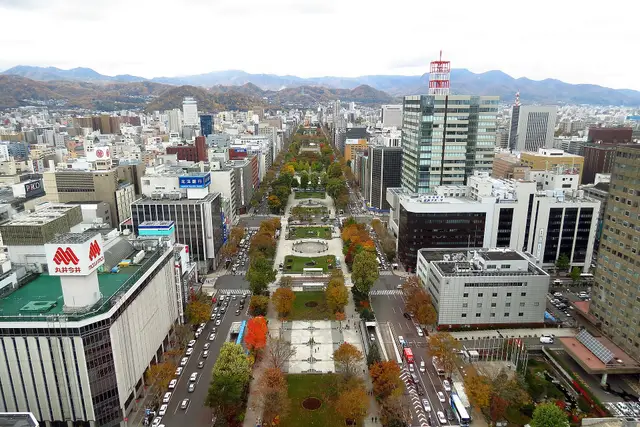
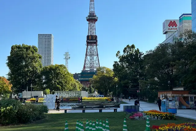
Odori Park, the Clock Tower and the red-brick former government office are all within walking distance on a grid of streets. Hokkaido's main city, also known for ramen, beer and the night view from Mt. Moiwa.
볼거리 대표 10곳
'대표 명소'와 '아는 사람만 아는 곳'은 이 사이트의 편집부가 고른 것이며, 인기 순위를 조사한 것이 아닙니다.
- 2
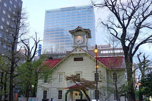
삿포로 시계탑
A wooden hall built in 1878 as the drill hall of Sapporo Agricultural College. The clock still chimes, and there is a small museum inside.
- 역사·건축
약 30분유료비 오는 날도 OK휠체어·유모차로 둘러볼 수 있음
도보 · Sapporo에서 약 10분 ・ 600m
- 3
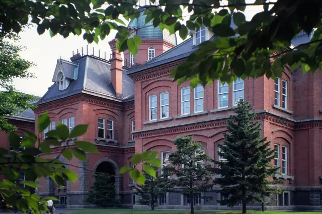
홋카이도청 구 본청사(아카렌가 청사)
A red-brick government building from 1888. The front garden with its ponds and trees is a short, pleasant walk from the station.
- 역사·건축
- 미술관·박물관
약 45분유료비 오는 날도 OK휠체어·유모차로 둘러볼 수 있음
도보 · Sapporo에서 약 8분 ・ 500m
- 4
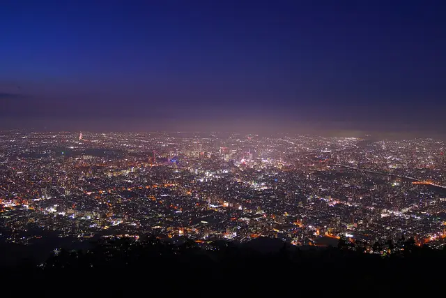
모이와산
The hill for Sapporo's night view, looking down on the city lights. A ropeway and a mini cable car take you to the top.
- 경치·전망
- 야경
약 60분무료휠체어·유모차로 둘러볼 수 있음
로프웨이 · Sapporo에서 약 60분 ・ Subway to Susukino, streetcar to Ropeway Iriguchi, then the shuttle bus and ropeway ・ 5.5km
- 6
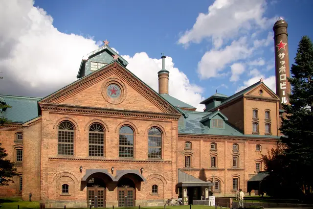
삿포로 맥주 박물관
A beer museum in a red-brick Meiji-era building. The beer hall next door serves jingisukan, grilled lamb.
- 역사·건축
- 음식·시장
약 60분무료비 오는 날도 OK휠체어·유모차는 일부만 가능
버스 · Sapporo에서 약 25분 ・ Bus from the north exit of Sapporo Station to Sapporo Beer Garden ・ 1.5km
지도에서 보기
대표아는 사람만 아는 곳
추천 코스
시각은 9:00에 출발한 경우의 기준입니다. 이동 시간은 거리로 어림한 것으로, 대기와 혼잡에 따라 달라집니다.
Walk the city center, then Mt. Moiwa at dusk
9:00 출발 → 14:40쯤까지(약 5.5시간)
- 9:00Sapporo
도보 약 8분
9:08홋카이도청 구 본청사(아카렌가 청사)머무는 시간 약 45분도보 약 8분
10:01삿포로 시계탑머무는 시간 약 30분도보 약 4분
10:35오도리 공원・삿포로 TV 타워머무는 시간 약 60분도보 약 10분
11:45스스키노머무는 시간 약 1.5시간교통편으로 약 25분
13:40모이와산머무는 시간 약 60분
Everything as far as Susukino is walkable. For Mt. Moiwa, take the streetcar from Susukino.
이 순서로 주유 플랜 만들기Maruyama and Shiroi Koibito Park on the Tozai subway line
9:00 출발 → 13:27쯤까지(약 4.5시간)
- 9:00Sapporo
도보 약 12분
9:12오도리 공원・삿포로 TV 타워머무는 시간 약 60분교통편으로 약 20분
10:32홋카이도 신궁・마루야마 공원머무는 시간 약 60분교통편으로 약 25분
11:57시로이 코이비토 파크머무는 시간 약 1.5시간
Odori, Maruyama-Koen and Miyanosawa are all stations on the Tozai Line.
이 순서로 주유 플랜 만들기
언제 갈까
June to September is mild (17–22°C on average), ideal for summer travel. February brings the Snow Festival but averages around −3°C, so dress for deep cold.
달을 가리키면 그 달의 기온과 강수량이 표시됩니다.
기온(선은 평균, 띠는 최저에서 최고까지)
강수량(mm)
볼거리 시기 기준
Cherry blossoms (Maruyama Park)
Lilacs (Odori Park)
Sapporo Snow Festival
Autumn leaves (Nakajima Park, Jozankei)
Snowy city scenes
표로 보기
| 1월 | 2월 | 3월 | 4월 | 5월 | 6월 | 7월 | 8월 | 9월 | 10월 | 11월 | 12월 | |
|---|---|---|---|---|---|---|---|---|---|---|---|---|
| 최고 (℃) | -0.4 | 0.4 | 4.5 | 11.7 | 17.9 | 21.8 | 25.4 | 26.4 | 22.8 | 16.4 | 8.7 | 2 |
| 평균 (℃) | -3.2 | -2.7 | 1.1 | 7.3 | 13 | 17 | 21.1 | 22.3 | 18.6 | 12.1 | 5.2 | -0.9 |
| 최저 (℃) | -6.4 | -6.2 | -2.4 | 3.4 | 9 | 13.4 | 17.9 | 19.1 | 14.8 | 8 | 1.6 | -4 |
| 강수량 (mm) | 108.4 | 91.9 | 77.6 | 54.6 | 55.5 | 60.4 | 90.7 | 126.8 | 142.2 | 109.9 | 113.8 | 114.5 |
기온과 강수량은 일본 기상청의 평년값(1991〜2020년, Sapporo)입니다. 볼거리 시기는 예년 기준이며 해마다 1〜2주 차이가 날 수 있습니다. 기상청 데이터
주요 교통수단
Sapporo Municipal Subway
Three lines: Namboku, Tozai and Toho. From Sapporo Station to Odori, Susukino and Makomanai; change at Odori for Maruyama-Koen and Miyanosawa.
Underground walkway (Chi-Ka-Ho)
About 10 minutes on foot underground from Sapporo Station to Odori. An underground mall continues on to Susukino, so walking is easy even on snowy days.
Sapporo Streetcar
A loop line running from Susukino and Nishi 4-chome around the southwest of the city. Get off at Ropeway Iriguchi for the Mt. Moiwa Ropeway.
Mt. Moiwa Ropeway
A shuttle bus runs from the Ropeway Iriguchi tram stop to the base station. Ride the ropeway, then a mini cable car to the top. It can stop for strong wind or maintenance.
Rapid Airport (New Chitose Airport – Sapporo)
About 40 minutes from New Chitose Airport to Sapporo Station. Some trains continue to Otaru. Delays are possible on snowy days.
Sapporo 가는 방법
'대표'와 '아는 사람만 아는 곳'은 이 사이트 편집자가 고른 것이며, 인기 순위를 조사한 것이 아닙니다. 소요 시간은 기준입니다. 요금·영업시간·운행일은 출발 전에 공식 안내를 확인해 주세요.
사진·데이터 출처
Odori Park in autumn and central Sapporo, seen from the TV Tower redlegsfan21 (CC BY-SA 2.0) / Flower beds in Odori Park with the Sapporo TV Tower ノボホショコロトソ (CC BY 4.0) / The Sapporo Clock Tower among trees Bjørn Christian Tørrissen (CC BY-SA 4.0) / The red-brick Former Hokkaido Government Office surrounded by trees user:Fg2 (Public domain) / Night view of Sapporo from Mt. Moiwa 掬茶 (CC BY-SA 4.0) / The red-brick Sapporo Beer Museum under a blue sky MIKI Yoshihito derivative work: MrPanyGoff (CC BY 2.0) / The worship hall of Hokkaido Jingu Shrine among trees Daigaku2051 (CC BY-SA 3.0). 잘라내고 축소했습니다.
이 지역의 음식
Hokkaido에 전해 내려오는 향토 요리입니다. 가정과 지역에서 만들어 온 요리가 많아, 식당에서 팔지 않는 것도 있습니다.
Ishikarinabe(Ishikari hot pot)
石狩鍋
“Ishikari Nabe” (Ishikari hot pot) is a typical local cuisine of Hokkaido.
- 전해지는 지역
- Ishikari region
Salmon Chanchan Yaki
鮭のチャンチャン焼き
“Salmon Chanchan Yaki” is a dish of steamed salmon and seasonal vegetables caught from fall to winter and seasoned with miso.
- 전해지는 지역
- Ishikari region
Ruibe
ルイベ
"Ruibe" is local cuisine made by freezing fish like salmon or trout, then eating them as sashimi as it thaws out. It is characterized by its frozen texture and a taste that slowly melts in your mouth.
- 전해지는 지역
- Ishikari City, Hakodate City, Kushiro City and many other coastal areas
Jingisukan (Lamb and Vegetable Hot Pot)
ジンギスカン/成吉思汗
During the Taisho era (1912-1926), as the outbreak of World War I made it difficult to import wool, there was a national policy to encourage sheep farming.
- 전해지는 지역
- All of Hokkaido Prefecture
Sanpei-Jiru
三平汁
"Sanpei-jiru" is a local dish consisting of salted fish, such as salmon or herring, stewed together with vegetables, such as carrots, and daikon radishes.
- 전해지는 지역
- All of Hokkaido Prefecture
Izushi
飯寿司
"Izushi" is sushi made by lactic acid fermentation in low temperature with fish, vegetables and Rice koji (=malted rice).
- 전해지는 지역
- All of Hokkaido Prefecture
‘먹을 수 있는 가게 찾기’는 요리 이름과 지명으로 지도 앱 검색을 엽니다. 검색에 나오는 가게는 이 사이트가 고르거나 추천한 것이 아닙니다. 그 요리가 있는지는 가게에 확인해 주세요.
출처: 농림수산성 ‘うちの郷土料理 (Our Regional Cuisines)’를 가공하여 작성 (2026-11-15 가져옴) https://www.maff.go.jp/e/policies/market/k_ryouri/index.html. 이름·전해지는 지역·재료는 원문 그대로이며, 설명은 원문의 일부입니다. 사진은 싣지 않았습니다. 이 페이지는 농림수산성이 만든 것이 아닙니다. 요리 이름과 설명은 영어로 표시됩니다.